Map, profiles of New York State canals and feeders
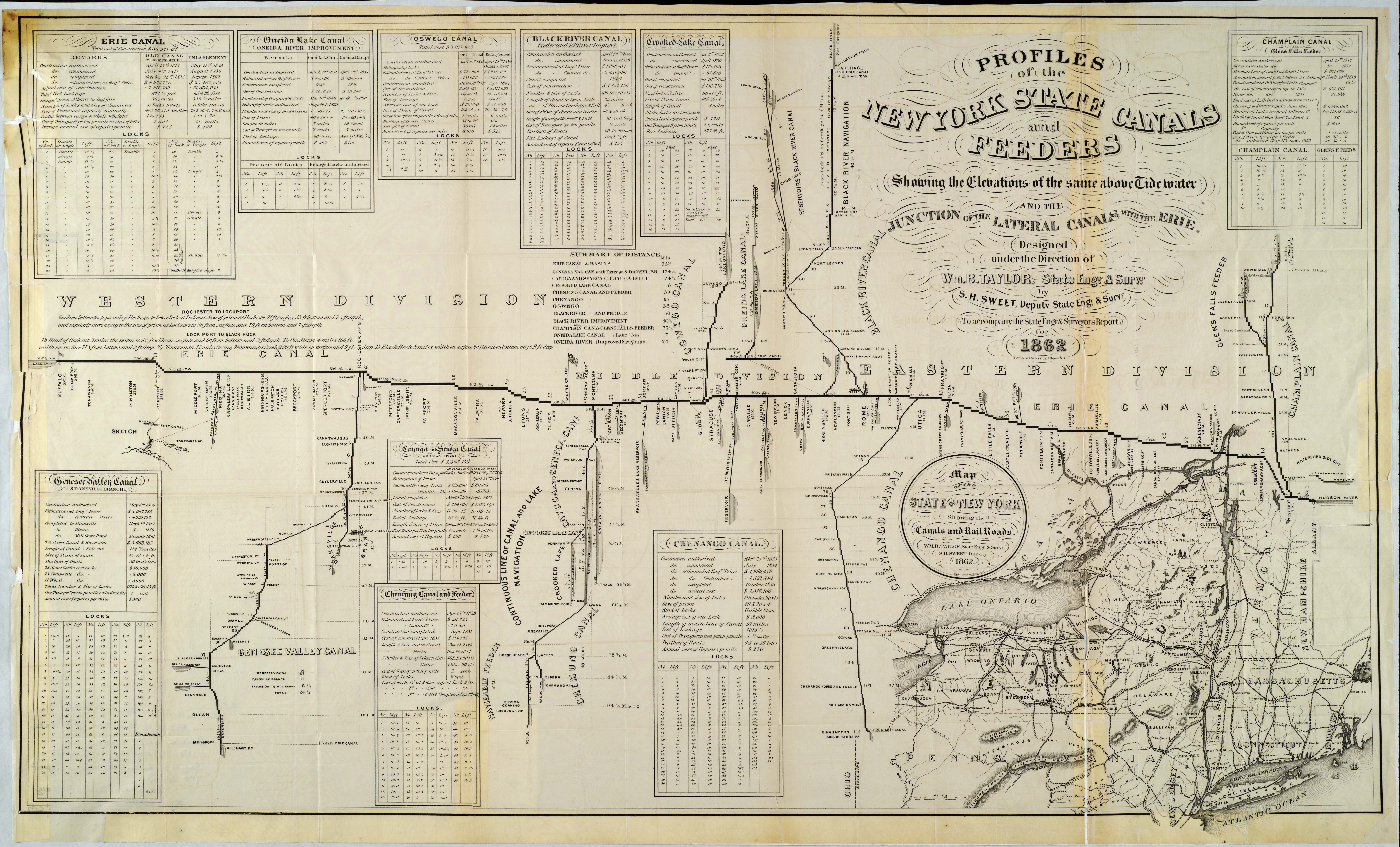
This detailed map accompanied the State Engineer and Surveyor’s report for 1862. It shows the elevations and locations of the canals and canal feeders in New York State and where these connected with the Erie Canal. It also shows a map of the state with all its canals and railroads, and provides information about these transportation systems.
Credit: Map by Sylvanus Howe Sweet (1830-1899). Courtesy of the Rochester Public Library Local History & Genealogy Division.
Click here to access the full record.